
I've mentioned how old highways used to be my main focus of interest back in the 1980s and 90s, and I was often curious about when a road had been widened or a bypass constructed. As a hobby, I used to pour over old maps to try and figure it out – followed by driving out to photograph the 'now' view.
So when I saw this photograph that appeared in the Journal back on August 2, 1962, my 'old road' curiosity was rekindled. As the caption notes, "Crews are engaged in what is being called the largest road improvement project in the history of the Huron County Highway Department on S. Norwalk Rd., a mile south of Norwalk between Ridge Rd. and Rt. 250.
"The task, elimination of a hairpin curve over a narrow bridge, entails the building of a new 900 - road and a new pipe culvert, necessitating the moving of 5,000 square yards of dirt."
Originally I thought that this project had something to do with the U.S. 20 bypass south of Norwalk, but it's actually a road located just south of it.
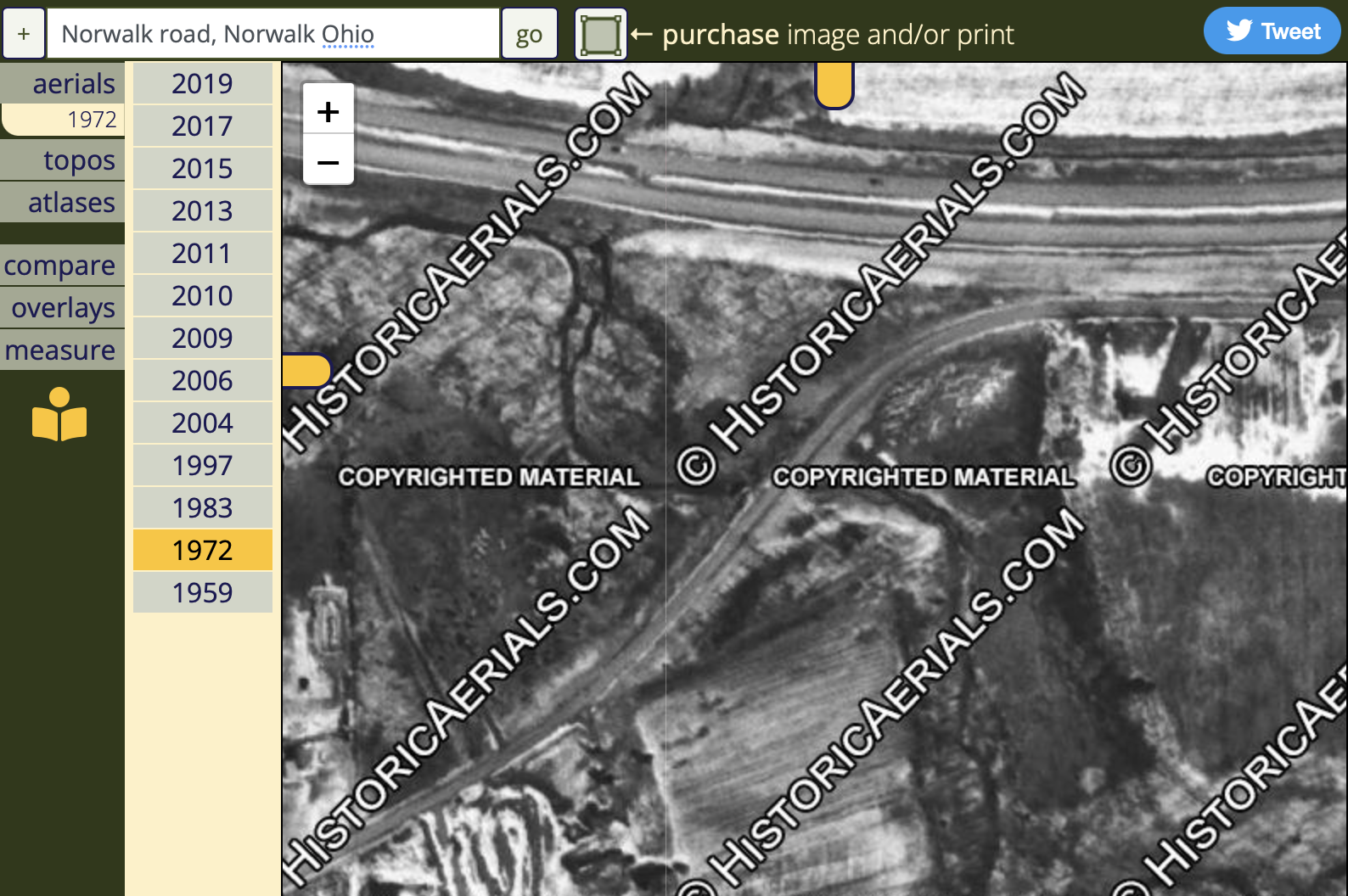
These screen grabs (courtesy of HistoricAerials.com) tell the story. The 1959 view shows the South Norwalk Road in its original hairpin curve alignment, and the 1972 view shows its new, sweeping curve. That's the US Route 20 bypass at the top of the '72 and 2019 photos.


Dan, I thought I was the only weirdo that enjoyed finding original routes of roads in the area. I've spent hours poring over the Historic Aerials and similar sites doing just that, along with finding old rail grades.
ReplyDeleteAn interesting spot is Rt58 where it crosses Black River north of Wellington. It has been realigned 3-4 times over the years and along with the nearby addition and deletion of the Interurban line to Wellington. The original(?) steel bridge frame is still in place, if you look close. It's nowhere near where you may think it would be.
The alignment of (old) US 20 from Elyria to the West is neat when compared to old maps prior to it's construction.
Roads are still a source of fascination, especially with the availability of vintage aerials. One of these days, I hope to finally prepare my post about the Rt 58 bridges over the Black River that you mentioned. It's probably one of my most postponed posts (second only to the series on the Pueblo). I've got a lot of material, I just need the time to sort it all out and write it up!
ReplyDeleteLol, I should have known...
DeleteI can't wait to read it.