Showing posts with label Skyline Drive. Show all posts

Monday, July 10, 2023

Skyline East Realty Ads – July 1962

Skyline Drive – the street on which my parents built their second house – has been a favorite topic on this blog.

But first a little backstory. After my parents got married in 1950, my dad's grandfather generously gave them a house on W. 30th not far from Broadway. It was a very small, old house that Grandpa Esterle owned and had been renting out. But the house had never been updated, and Dad ended up wiring it and doing a lot of improvements. Eventually, my parents decided it was time to build a new one for their growing family; thus they built a house on W. 30th Street, west of Oberlin Avenue and close to Ashland Avenue. It was the house I grew up in, and I have many happy memories of it. (I wrote about a 2006 visit to that house here.)

But at some point, my parents learned that a new junior high (Masson) was going to be built, and that kids had to live south of Meister Road to attend it. So my parents decided to build another house inside that border line to make sure my siblings and I got to go to a brand new school. Thus they bought a lot on East Skyline Drive and built another house. We moved in during late 1965. (As it turns out, my siblings and I would have attended Masson Junior High even if we hadn't moved; oh well.)

How did my parents find out about the new houses going up on Skyline Drive, east of Leavitt? Back in July 1962, there were several ads in the Journal that might have caught their attention. Below is a full-page ad that ran on July 7, 1962.

In that same edition of the Journal was this article about an Open House on East Skyline. I immediately recognized the house as being in the next block and home to the Protenic family.

A week later, this smaller ad ran on July 14, 1962. Hey, there's another 'Housewife in Paradise.'
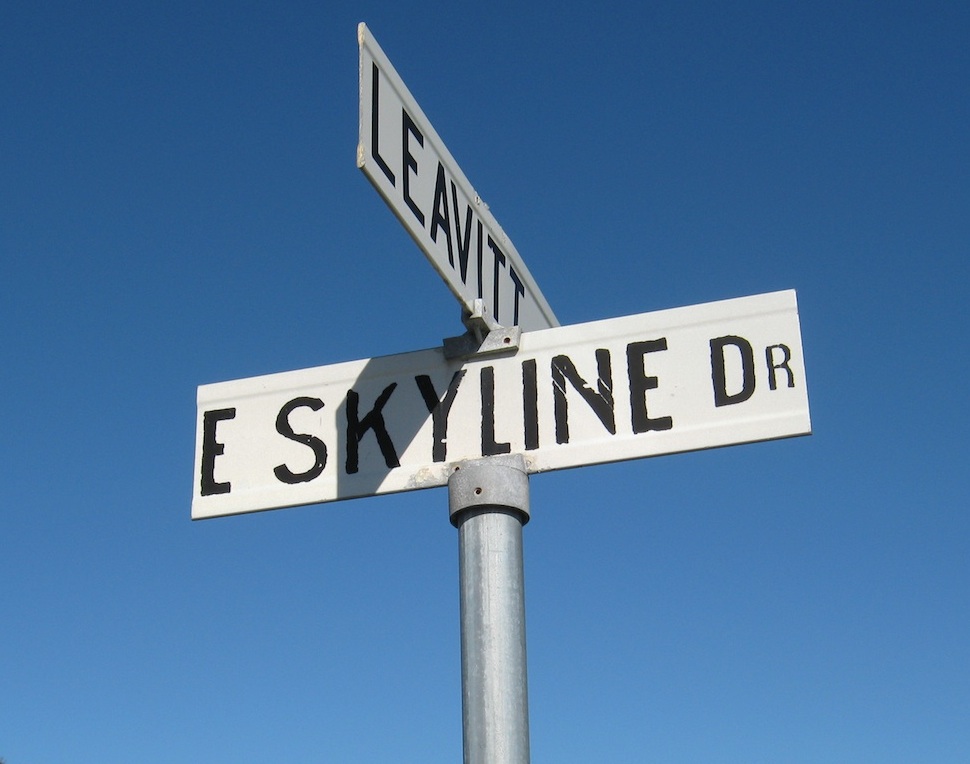
Mom had long told the story about how the people living on Skyline Drive across Leavitt Road had fought against their elite street name being used for the continuation of the road east of Leavitt. (I'm not sure where Mom got that information.) Today, most (but not all) of the street signs in the area still say 'East Skyline Drive.' It's odd, considering that you don't see East Meister Road – a named road that crosses Leavitt just like Skyline does.
As for the house in the Open House ad, it still looks pretty much the same today.
****
Today, my family's former house on Skyline Drive is owned by someone else. 
It's strange, but when I had to put it on the market in the fall of last year, I had no feelings at all about it. It had to be done, and it sold quickly. But now, the realization has finally sunk in that the house is no longer 'home' – and it bothers me. 
I dream about the house a lot. 

Tuesday, July 25, 2017

Skyline Park Ad – June 1965

Here’s one final new home development ad for now. It’s for Skyline Park, located west of Leavitt Road and south of Skyline Drive.

The ad ran in the Journal on June 5, 1965. Apparently it's from the second phase of Skyline Park (note the “No. 2” after its name). I posted earlier Skyline Park ads from 1963 and 1964 here.

What’s interesting about the ad is the map showing the route to Skyline Park. Leavitt Road was being widened at that time (which I wrote about here), necessitating the circuitous route shown. Hey, this map has north at the bottom too!

As our house on East Skyline Drive was under construction at the time of this 1965 ad, I’m sure we had to take the same winding route from Oberlin Avenue to check its progress. We moved in during December 1965, just about the same time Leavitt Road was completed.

If I remember correctly, although East Skyline Drive did go through to Leavitt, it was unpaved beyond our house.

We called the whole grassy swampland between us and Temple Avenue "the field." It became such a popular area for people to dump their trash that the city had to erect a "No Dumping" sign.

It was on that same land that a plane crashed in 1971 (which I wrote about here).

Tuesday, August 27, 2013

Skyline East Ad – July 7, 1962

Here's an ad I never thought I'd see: one for the Skyline East housing development. The ad ran in the Journal on July 7, 1962 – 51 years ago last month.

The ad kind of fits in nicely with all of the early 60s Grand Opening ads for Lorain west side businesses I've featured last week on the blog.

The Skyline East area came into being because a horse farm (the Louis Hait Stables) kept it from connecting up with W. 35th Street. By the 1970s the farm was gone, and the two streets connected.

You might remember that back here I had done a whole series of blogs about growing up on East Skyline Drive. This ad seems to add some weight to the argument that there was a very big distinction made between the homes on the west side of Leavitt and those (like ours) on the east.

Strangely enough, the map doesn't even show Skyline East connecting up with Skyline Drive across Leavitt. (Maybe that was to make those uppity Skyline West people happy!) The map's not quite to scale either, and Marshall Avenue isn't even labeled. Palm Springs Drive isn't on there either.

It's also strange that the map shows Skyline East extending all the way to Leavitt Road. For a few years after we moved in, the road from our house to Leavitt was a dirt road, and I remember that we had to approach our house from the east.

The ad mentions that Skyline East offered Early American homes in a variety of styles. I guess that meant that there was an eagle plaque mounted on the outside of the house.

Anyway, here's a link to a short article examining why Early American was popular in the 1950s and 60s.

Friday, April 27, 2012

Skyline Park


I may have grown up on East Skyline Drive in Lorain, but I never knew there was a development called Skyline Park on the west side of Leavitt Road. Here's an ad for it from the Lorain Journal of September 7, 1963. (Click on it so you can read it.)


The 'Lorain Incorporated' logo in the ad is kind of cool – a nice little bit of graphic design.

Anyway, the ad makes Skyline Park seem like a pretty swanky area. It notes that it is "located in Lorain's newest and most desirable location, with beautiful Skyline Drive bordering on the north." It lists many development attributes that were probably new ideas back then, but are generally accepted as the norm now.

Here's another Journal ad from May 1964 featuring just one model. I suspect the ad has a typo, since Maine is on the east side of Lorain! (It's supposed to be Miami.)

Like I've mentioned before in past posts, I'm pretty sure the homeowners on Skyline Drive resented the rabble living on the east side of Leavitt (such as us) appropriating the name of their street.

Nevertheless, I enjoyed growing up on East Skyline Drive, even though the occasional plane might drop out of the sky near our house.

Wednesday, April 25, 2012

1971 Plane Crash on Skyline Drive

Bob Kovach sent me this newspaper clipping last year of something I remember very well from my childhood days on Skyline Drive: the day a plane unexpectedly nosedived in the field right next to our home. It appears below just as it ran in the Lorain Journal on Monday, August 30, 1971.

Plane Misses Homes, Nosedives into Lorain Field
By PAM ROBINSON
Staff Writer

A SINGLE-ENGINED Cessna 150 dipped out of the sky over Lorain yesterday narrowly missing several homes on heavily-populated Skyline Drive east before nosediving into a vacant lot.

Instead of a tragedy, it turned out with a "believe-it-or-not" twist. Pilot Isom Elrod, 49, of North Ridgeville wasn't hurt. His only ailment, compressed air sickness – commonly known as "the bends."

He is listed in fair condition at Elyria Memorial Hospital.

Last week a similar plane malfunction ended in tragedy. Two people were killed when a twin-engined plane crashed into a house in Fairview Park, shortly after takeoff from Cleveland Hopkins airport.

POLICE SAID Elrod, who lives at 7420 Root Road in North Ridgeville, told them the plane developed engine trouble while he was on a practice flight from Lorain City Airport. When he tried to make a landing in the field the aircraft hit a boulder, causing the nose to burrow into the ground. Elrod said he was following his son, Jack, 16, who had just landed at the airport in another Cessna.

James Smith, 4002 Marshall Ave., Lorain, said he heard the engine fail when the plane was over his house.

Carl Travee, 47, 2110 Skyline Drive, Lorain was sitting on his porch when the accident occurred.

"I noticed it was coming in awful low and then I saw its propeller wasn't even turning," he said. "I ran over to the field (at the corner of Temple Court and Skyline Drive) and propped the man (Elrod) up and asked him if he was hurt. He said no, he didn't think so."

"Some kid came by and sped down to the fire station (at the corner of Meister and Leavitt roads) to get an ambulance," Travee added.

The owner of the vacant lot, Leo Dembek, 63, of 3507 Leavitt Road, Lorain, said gas was leaking from the plane's wing when he arrived.

Dembek also said that this was the fourth crash in the area since he bought the land in 1945.

Elrod was taken to St. Joseph Hospital, Lorain immediately after the crash, checked out for injuries, then moved to the Elyria Hospital, nearer to his North Ridgeville home.

Officials at St. Joseph said Elrod's illness was caused by coming down from a high altitude too rapidly. Usually "bends" sufferers are associated with underwater or tunnel accidents.

Elrod is employed at the National Aeronautics and Space Administration's Lewis Research Center in Brook Park, a Cleveland suburb.

The Federal Aviation Administration said it is planning an investigation of the crash.

****
The article brings back a lot of memories for me. We were eating dinner in the basement on that Sunday in August to keep cool if I remember correctly, because when we heard the crash we had to go upstairs to see what happened. I remember running over there along with everyone else to see the plane. It was surprising, but not so much considering that planes flew over our house all the time since it was on the approach to the Lorain City Airport.
The gentleman that my family referred to as "the farmer" – Leo Dembek – is mentioned in the article, and it's probably the first time we ever knew his name. As I mentioned back here, we could see his farm house from our dining room window.
The area shown in the photo bordered by Skyline Drive and Temple Avenue is lined with homes today. 
Thanks again to Bob Kovach for saving that article and sending me a scan of it.

Friday, July 29, 2011

Summer Fun in Lorain 1969

Here's an interesting article about the ambitious playground program Lorain used to have in the 1960's. It's from a Lorain Journal of early June 1969. (Give it a click so you can read it.)

I've blogged before about growing up on Skyline Drive. I remember walking down to Willow Park with my siblings so we could take part in some of the summer activities going on down there. I remember it was a lot of fun, with some great college kids running the whole thing. Besides the organized games, there were lots of crafts too.

Willow Park was such a great setting. The woods used to be dark and thick, and great to explore, although you could only go west along the creek so far. I know we used to catch a lot of minnows and crayfish in there. What we did with them, I don't remember!

As for today, Lorain's website makes reference to a youth summer playground program, but on the schedule page it says,"The summer playground program will not be held in 2011 unless funding is received."

I feel sorry for the kids.

Willow Park

Sunday, November 14, 2010

1960's Memories of Skyline Drive Wrap-up

Hope you didn't find my look back at growing up on Skyline Drive in the 1960's too self-indulgent! It was a pleasant walk down Memory Lane (East Memory Lane, heh-heh) for me, and it was nice to get it all down here before I forget even more. Thanks goodness my siblings have better memories than me – they're still coming up with stuff that I forgot to mention.

My sister recently emailed me and asked, "Remember hearing the peacocks over at the Davidsons'?"

I had to laugh. I had forgotten all about those peacocks. Yet we heard them every day for years!

Speaking of the Davidsons, I remember that sneaking onto their property (only to be chased off by their gardener) seemed to be a hobby of many of the thrill-seeking kids in the neighborhood.

Then there was the Skyline Drive Block Party, which my younger brother Ed remembered. It was shortly after we moved in, during the warmer months. The street was blocked off at Marshall Avenue, tables were set up and we had a big cookout.

It's funny to think of that now – a very quaint thing, the idea of getting to know your neighbors better.

But I'm sure my memories of Lorain back then aren't too unique. Every development and neighborhood has a history, a story to tell, by its longtime residents. It's a pity that we don't always remember to take pictures of things before they're gone.

There's been more change in many parts of Lorain County in the last few years than in the last thirty combined. You can drive by an old farmhouse for decades, and then all of sudden – it's gone! I've kicked myself time and time again for not snapping a shot of something that was demolished.

Anyway, be sure to document memories and stories of your neighborhood, especially if you have young children. They might find it interesting some day.

They might even use it in their blog!

1960's Memories of Skyline Drive Part 5


So far, I've talked a lot about things at the west end of East Skyline Drive. It's about time (as this blog series is drawing to a close) that I get to the east end of the street! That would be where E. Skyline Drive meets Palm Springs Drive at Willow Park.

This part of the neighborhood has gone through a lot of change since the mid-1960's. Back then, E. Skyline Drive did not connect up with W. 35th Street to the east. Since it didn't connect with Leavitt Road either, you had to access it by Palm Springs Drive or Marshall Avenue.

The aeroplat map from the early 1960's (below) shows why it didn't connect up with W. 35th Street. (Click on it for a larger view.)


The property outlined in red was in the way.

And what was on that property? It may seem hard to believe now, but that is where the Louis Hait Stables were located. The earliest city directory listing I could find was in 1964 at 1475 W. 35th Street. The last listing was in 1969.

I can still see the large barn on the property in my mind. It was towards the W. 35th Street end and the top of it was visible from Palm Springs Drive. I remember seeing horses there too, perhaps from some Willow Park vantage point.

Although I never ventured in close to get a good look at the barn, I happen to know someone who did – my brother Ken! He and a few pals checked it out on a few occasions.

Here are Ken's observations (right from the horse's mouth)!

"They referred to it as "Doc Heights' [sic] Horse Barn." It was dark, had stalls, and was full of horse crap.  As I recall, the building was in pretty good shape. We only went in a few times, it was hard to get to but I don't remember why, a lot of brush or barbed wire maybe. Also there was absolutely nothing to do in there, no horses.  It was pretty well hidden in the brush.

Anyway, the property was developed in the 1970's. Edgewood Drive was extended north from W. 38th Street across the property to meet up with W. 35th Street, and W. 35th Street was finally connected to E. Skyline Drive.

****

Willow Park was the scene of a lot of memories in the late 1960's. There was the creek, that was fun to explore, and good for catching turtles, crayfish and minnows. Plus, Lorain had a really good Parks and Recreation Department back then, and I remember some great summer programs at the park. It seems there was always something going on – crafts, games, etc. –  to keep the local kids entertained. The summer employees at the park that coordinated the activities were really nice.

The playground equipment at the park back then (long since removed and replaced) was of the standard variety; a wooden carousel that you could spin around on (and get pretty dizzy) and the 'spring riders' that the small fry could bob around on.

The shot at left, while not from Willow Park, shows what I'm talking about. It's from a great flickr® site of vintage Ohio Spring Riders, which you can access by clicking here.

Willow Park, as many of you remember, was not only for play. The park and its well-known bridge over the creek was an important hub for getting to school.

Kids who lived over by Meister Road had to walk through the park to get to Masson Elementary and Masson Junior High; those of us who lived by Masson had to go through the park to get to Admiral King (unless you wanted to walk all the way to Ashland Avenue).

For those of you who walked to Admiral King through Willow Park, here's a 'virtual tour' down the ol' sidewalk, photographed this summer. (Click on each for a larger view.) Hope there's no bullies on the bridge!


Of course if you followed the sidewalk across Meister Road, you hooked up with the sidewalk that I knew as 'the blacktop' (discussed here).

You'll notice that the bridge looks a little different. Apparently it was replaced in the 1990's, judging by a dated plate mounted on it.

Willow Park is still an impressive neighborhood park, and it was well-maintained when I walked through it. Here's a view of the creek looking east from the bridge. (The creek looks like it's still in its natural condition, although not as deep as it used to be.)


And here's the view to the west from the bridge.


Here's what the park looks like these days.


And if you were going to head home, back up the sidewalk to Palm Springs and/or E. Skyline Drive, it looked like this.


The Louis Hait Stables would have been to the left of the white house at the top of the sidewalk, beyond its backyard and a wee bit south.

Thursday, November 11, 2010

1960's Memories of Skyline Drive Part 4

When my family reminisces about the early years on Skyline Drive, thoughts and memories inevitably turn to a man we nicknamed, "The Farmer." I don't believe we ever met him, although we caught glimpses of him from time to time.

He lived at 3507 Leavitt Road (State Route 58) next to where E. Skyline Drive would eventually be built. It is my understanding that all of the land in the area had been part of his property at one time. The aeroplat map of Amelia Meadows seen in Part 1 of this series seems to confirm that all of the various lots were connected to each other and to where the Farmer lived.

He and his family lived in an old white house that was barely visible from Leavitt Road. We saw the back of it from our house, along with some ramshackle barns and other small buildings. The view to the west (across the field) from our kitchen window looked like this.


(Fortunately I had drawn it as a sketchbook exercise for my high school art class.)

Since the whole area was part of Black River Township until the late 1950's, it is difficult to research the property and its residents. I did manage to find one listing of it in the 1954 Lorain County Farm & Business Directory:

DEMBEK Leo M (Amelia: Dolores 14, Leona 19) Owner; 111 acres - general livestock poultry, 35, State Route 58 3507 Leavitt Road Lorain

My guess is that his wife's first name was lent to the Amelia Meadows subdivision.

The view never really changed from the sketch above, even when the new homes replaced the field and Temple Avenue was constructed behind his house. The old house and structures were just something that you got used to seeing, year after year, until you didn't notice it anymore.

Then one day, I saw this in the newspaper and my heart sank. (Click on it for a larger view.)

June 9, 1999 Journal clipping

I felt almost sick to my stomach. Not because something that I associated with my childhood was being demolished, but because the house was apparently one of the oldest in Lorain.

Here, the first time I actually get a good look at the front of the house, it's being demolished. What I would have given to just walk through the house – or its grounds – before it was gone. I'm sure the property had a story to tell, through artifacts in the soil.

But that's the way it goes, especially in Lorain. Here is roughly the same view today. I wonder if the homeowners are aware of what was on that property before their houses?

Southeast corner of E. Skyline Drive and Leavitt Road

Tuesday, November 9, 2010

1960's Memories of Skyline Drive Part 3

One of the things I associate with those early years on E. Skyline Drive is something that many Lorainites will also remember: the airport at the northwest corner of Meister Road and Leavitt Road.

City directories at that time list it as being called the Lorain City Airport and it was also known as Long's Airport.

The reason that this airport is so much a part of my memories is because our house on E. Skyline Drive was directly in the line of approach for the landing strip. (If you look at the map at left, the runway points downward to the 'S' in SKYLINE which is where our house was.)

Consequently, my family would constantly see small planes coming in diagonally across the sky, coming in for a landing. It was a sight that we would get very used to. My brother Ken humorously compared it to watching a bunch of 5 O'Clock Charlie's (from the well-known M*A*S*H episode).

At least once, our proximity to the airport resulted in some excitement. A plane unexpectedly (and loudly) landed in the field a few hundred feet from our house. I still remember running over to the plane along with everyone else to see what happened. I can't remember why the pilot was forced to land there, but my family still talks about 'when the plane crashed by our house'.

The airport closed in the early 1970's, bringing to a close Lorain's long era of municipal and private airports. It was replaced by a Clarkins department store at the site around 1973 or so.

It was rather comical that a few years after the airport closed, we continued to see airplanes making the familiar approach for the runway that was no longer there!

The Clarkins store eventually closed as well. Today the airport site is the P.C. Campana Industrial Park, home for a variety of companies and organizations, including Fastenal Co., Skylift and the Lorain Preparatory Academy.


The former Clarkins store

Looking at the site today, a newer Lorain resident might find it hard to believe that an airport was there for so many years and that Lorain actually had a need for one.


Next: The Farmer

Sunday, November 7, 2010

1960's Memories of Skyline Drive Part 2

When I turn onto E. Skyline Drive off of Leavitt Road these days, I sometimes have a hard time remembering the way it all used to be back in the mid-1960's, when my parents moved our family there.

Back then, the area around our new home was right in the middle of transforming from farmland to suburban neighborhoods, just like some of Lorain's west side had already gone through a decade earlier. But the difference is, this time we had a ringside seat to watch it all.

As the last house on the block, we had a unique perspective, because our yard was adjacent to the undeveloped land to the west and to the south. The road sort of ended in front of our house, and trailed off towards Leavitt Road as a dirt path.

To the west of us was a field, which was sometimes swampy and sometimes dry. The field extended north to Martin Run (the creek that ran roughly parallel to Skyline and Meister) and south all the way to W. 40th Street and beyond.

It is my understanding that this huge parcel of land had been owned by a gentleman who we had always referred to as "The Farmer". We could see his house if we looked out our west window across the field. (More on the farmer in a future part of this series!)

****

To kids used to a sterile post-war neighborhood of streets laid out in a perpendicular pattern, living next door to an undeveloped field was a veritable wonderland. The field was full of frogs and toads, which my brothers and I would eagerly catch and bring home as unfortunate pets.

Pheasants could be seen occasionally meandering through the field, and killdeer were a common sight. Their distinctive cry still makes me nostalgic for those days.

My brothers and I were always playing in the field, and we used a huge rock next to our yard as a sort of base of operations. We would set up our elaborate G.I. Joe camp around it, and use it as a mountain from which our G.I. Joe's could rappel down. My younger brother Ed remembers that the rock was covered with all kinds of unusual fossils. (I wonder what ever happened to that rock?)

Rabbits seemed to be everywhere. Strangely, I don't remember ever seeing any other kind of wildlife around there – no deer, raccoons, possums, skunks, groundhogs, etc. – just rabbits.

I remember several times trying to catch a rabbit with a homemade trap set up out in the field. Unfortunately, my research on constructing a trap was limited to watching Bugs Bunny cartoons. I tried both propping up a box with a stick (with a carrot tied to it) and digging a hole and camouflaging it with sticks and brush – with no success!

Exploring by the creek 'across the street' (there was no street yet) was even more exciting, because at the time, it had not been paved over and 'improved' for use as a storm sewer as it is today. Back then, it was still in its original form, and you had to slide down a rocky cliff to get to it. Once a kid got there, he could catch all sorts of things, including crayfish, turtles, minnows, tadpoles and small fish.

We were always going over there with our boots on, and coming home with something else as a pet. We would even have crayfish races in our driveway. (I've often wondered if my brothers and I wiped out that whole wetland ecosystem.)

We didn't go too far into the woods by the creek, because often there were 'big kids' in there smoking.

****
A house was built directly across the street from us a few years after we moved in. Later on in the early 1970's, homes were built to the west of us, and E. Skyline Drive was finally extended west from in front of our house to Leavitt Road.

Like all kids, we had to investigate these new homes as they were being built. There's something very interesting about tromping around inside a home under construction. But as interesting as that was, we hated to see the field disappear.

The eventual owner of the house next to us turned out to be a great guy and became a good friend to my father, truly the best neighbor we could ever ask for.

Today the area that comprised the field is a neighborhood that looks, well, kind of like what we left over on W. 30th Street!


Today the whole area by the creek that we used to explore (behind the Jehovahs Witnesses Kingdom Hall at 2330 E. Skyline Drive) is nicely graded, landscaped and is unrecognizable to me. But at one time, it was an exciting place for a kid to poke around.

Looking east from Leavitt Road towards Martin Run today

Next: The Airport

Friday, November 5, 2010

1960's Memories of Skyline Drive Part 1

Real estate ad from the Lorain Journal of May 15, 1954
Skyline Drive. 
The name still sounds vaguely chic to my ear. Maybe it's because the name suggests a trendy neighborhood on the western edge of a community, silhouetted against the horizon.
Before I get carried away here, however, I've got a confession to make. My family didn't really live on Skyline Drive. We lived on East Skyline Drive.
It makes a difference, which I'll explain. But first, a short history lesson of the area.
****
Skyline Drive first appeared officially in the Lorain City Directory in 1958, but the street and many of the homes listed had already been there for many years. A quick check of some of the homes on the Lorain County Auditor's website shows that the earliest ones were built in 1951. A few more were built each year until 28 homes were listed in 1958.
As you can see from the 1959 map (below), only the portion of the street west of Leavitt Road (Route 58) existed at that time. The eastern portion where we moved to in 1965 would follow later. (Click on the map for a closer look.)
The whole area east of Leavitt from the creek south to W. 40th and east to Edgewood Drive hadn't been developed yet.

Anyway, Skyline Drive in the 1950's must have been a fairly elite address. It was part of a brand new development with bigger lots and consequently, bigger homes. (It was still part of Black River Township in the 1950's.) Plus, it didn't conform to Lorain's standard street naming system of numbering the roads from north to south. That made the name a little bit special.

Thus when it was time to develop the portion of Skyline Drive on the east side of Leavitt, it was my parents' recollection that the residents on the west side objected to the use of the Skyline Drive name.

Whether that's 100% true or not, I'm not sure. All I know is that our street sign read E SKYLINE DRIVE and the sign on the other side of Leavitt Road read just SKYLINE DRIVE. Which makes East Skyline Drive the only 'east' address on the west side of Lorain.

****

Here's another map of the area a few years later – some time in the early 1960's. A lot of change occurred in a few years!

The map includes several iconic Lorain landmarks, such as the Westgate Shopping Center, the Lorain Plaza Shopping Center and the airport. 

Although the map shows E. Skyline Drive reaching Leavitt Road, it didn't happen until later.

For several years, Skyline Drive ended in front of our house, which in 1965 was the last one on the block. The street then trailed off towards Leavitt as a dirt road before disappearing in the field.

Temple Avenue didn't exist in 1965 either, only on paper.

Also note that Skyline Drive's eastern terminus was Palm Springs Drive. Since there was no access from Leavitt Road, we were kind of landlocked. To get to our house, we had to come in on either Palm Springs Drive or Marshall Avenue.

This map of the Amelia Meadows allotment from the same time period will give you a better idea of what it was like at the time we moved in. Notice that the streets are mapped out but in reality weren't built yet. And that was one big piece of property waiting to be developed.


We lived where the red 'X' was, and as you can see, we were indeed the last house on the block on the south side of the street. In 1965 there were no homes behind our house all the way to W. 40th and beyond. 

Well, I showed you all the maps. So what was it like for a kid living in that part of Lorain at that time? Stop back here next time and find out!

Wednesday, November 3, 2010

Next up: Skyline Drive Memories


Back here, I wrote about what it was like to attend Charleston Elementary School in Lorain during the early 1960's.

But shortly after I started first grade, my parents moved the family from the 1950's ranch they built on W. 30th Street to a brand new house on Skyline Drive, a few streets away to the south.

The new house was only a few minutes from our old house on W. 30th Street, but it might as well have been a hundred miles away. Because not only was our house in a different school district, it was in a unique part of Lorain that was right in the middle of transitioning from farmland to neighborhoods. Which made it a whole new world of fun and wonder for kids that were used to monotonous, numbered streets laid out at perfect right angles to each other.

So please stop by here next time for Part 1 of my look back at 1960's Memories of Skyline Drive. I think you'll find that many of the memories discussed are your Lorain memories too.