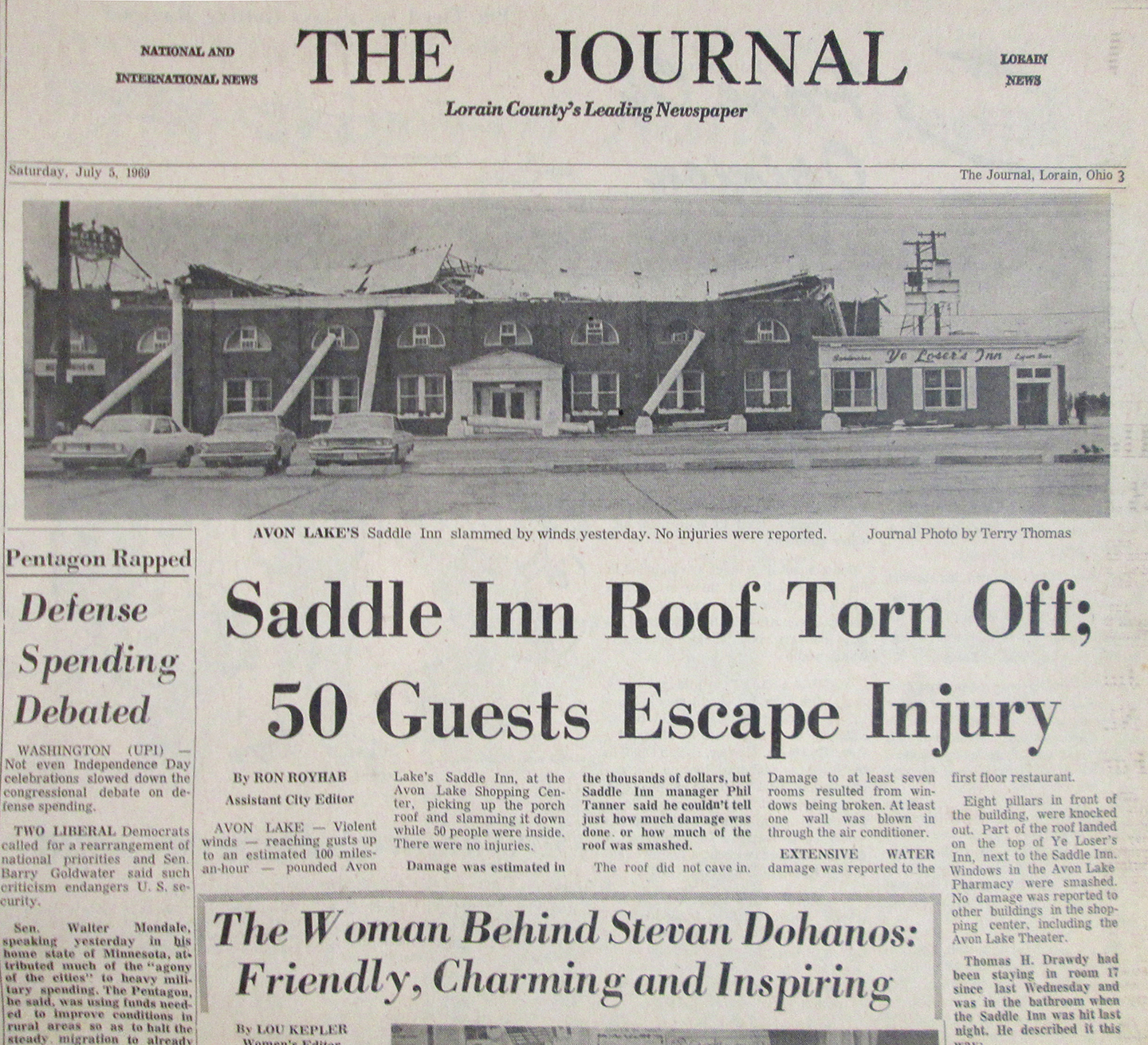
Here’s an interesting article that ran in the Lorain
Journal on September 24, 1969. It explores the possibility that the infamous July 4, 1969 flood washed away enough trees and soil on the property of a local couple to reveal the remnants of an old stagecoach stop in Birmingham.
Read all about it in the article below by Charles Gray and Ruth Bradford.
****
Larue Biddinger’s Home on Vermilion River
Did July 4 Flood Uncover Old Town?
By Charles Gray and Ruth Bradford
BIRMINGHAM – Flood waters from the rampaging Vermilion River, which did still uncalculated damage in the district, might have uncovered foundations and remnants of the old town of Terryville, which consisted mostly of an overnight coach stop and tavern for travelers in the pioneering days.
An article in the early June edition of The Journal described the Larue Biddingers’ 8-acre, park-like home along the Vermilion River next to the Garfield Road bridge. It told how the Biddingers had retained the natural beauty of the area while installing rock gardens, a pond, picnic shelter and playgrounds and a bird sanctuary and adding a variety of trees to the many species left there by nature.
The storm-swollen river swept over about three-fourths of the Biddingers' acres. The house escaped, but the woods and the picnic area were flooded. About three acres of huge old poplar and sycamore trees – some of them 80 feet tall – were swept downstream and deposited horizontally along the bank and in the woods that remain. The picnic grounds were completely destroyed. Tons of rocks were left in their place and the landscaped banks of the river were washed away.
“My wife named the place 'Rock Haven’ many years ago,” Biddinger said. “She has twice as many rocks now.”
As he looked over the area where eight to 10 feet of the river bank has been washed out, Biddinger discovered what appears to be a wall, part of a building or an old foundation. Further examination showed parts of three such walls formed of old-style brick, some of it mortared to chiseled sandstone rectangularly-shaped pieces. The mortar still clings to several pieces of sandstone. A rectangle of stones which show heat defects was perhaps a fireplace. Some pieces of old iron were found in the same spot.
ALL THE REMNANTS of walls were under the soil on which had stood trees that must have been 100 years old before they were swept away by the flood. Biddinger said that the stump of a sycamore tree three feet in diameter that still balances atop one of the walls, was dead when they moved there 15 years ago.
He says that some area residents who are interested in the history of the district told him there was probably a sawmill, woolen mill or tanner there in 1839, the earliest records available.
The walls may be part of a town called Terryville, Biddinger believes. He wonders whether a similar flood, maybe 150 years ago, covered the buildings with soil and that trees later came up on the spot.
An interesting artifact uncovered is a piece of wood, probably oak, well blackened from its years of burial on the river bank. About 52 inches long, two inches thick and perhaps 20 inches at its wide end, it is drilled in several places and contains 11 wooden pegs – the pioneer method of fabricating. A cut out area in it is tapered as though it might have been part of a shelf which held a large kettle or sink.
Just west of the Biddingers' ranch-type house is an old gazebo-type building he calls a spring house. “There’s a large foundation under this and there’s a spring down there. The foundation is big enough to have supported a tavern, if this is where it was,” Biddinger said.
Biddinger added: “This verifies rumors that something was here, but these are all hand-me-down stories. The records don’t go back that far.”
IF THE TAVERN did exist on the Biddingers’ land, the buried structures now uncovered on the rider bank might also have been a forge where stagecoaches and wagons could be repaired and horses shod. This would account for the stones which are burnt to a pink on the tops.
Describing the July 4-5 flood, Biddinger said he and his wife watched the damage from the house. “You’d hear a tree snap and see it topple. Then another. We kept watching the picnic shelter. When the water got to the top of it, it went.” Their 30x30 foot shelter contained a kitchen with serving window and tables and benches nearby for seating 100 people. All were washed away.
“The water covered the pond near the house and lapped at the foundation of a nearby new barn. I later took a house trailer top complete with chimney from that pond.
“Rugs were wrapped around the trees and parts of trailers which came down the river and hit the bridge and broke up are all over. There are stoves and refrigerators from these still out in the neighboring yards. I imagine if most of those trailer people hadn’t gone away for the holidays, somebody would have been killed.
The Biddingers have discovered some new rocks since the flood. There are many more bits of iron pyrite, the so-called “fool’s gold” which sparkle in your hand. There is a shell-shaped boulder with a regular wave pattern similar to those shown in geologist’s graphs of the ice-age formation of the beach ridges of Lake Erie.
He held up another. “This is a cone rock – made of limestone formed under pressure. A geologist told me there shouldn’t be any of this west of Rocky River. But after he saw it, he agreed that’s what it was.”
“This flood was higher than the 1913 flood. Rueben Wenzel, an old-timer around here, said the water in the 1913 flood was a foot below the bridge on Route 60. This one went over the bridge railings, so I figure it crested about 6 feet higher.
“OUR GARDEN is gone. In place of the soil and about as deep as I rototilled, there is just sand and shale. It seemed like wherever the land was disturbed, it went away and shale was left in its place.”
Mr. and Mrs. Biddinger are reclaiming their land. Using a tractor with a scoop and one with a blade, they have cleared much of the area. Biddinger will use a chain saw to clear the many fallen trees and bulldoze away the roots and shale as best he can.
Their loss, which was uninsured against floods, in unestimatable, but Biddinger says to him it is a challenge.
“The place will never be the same, but we’ll do something with it if we live long enough,” Mrs. Biddinger said. Right now there Biddingers are planning a series of Japanese rock gardens on the hardest hit parts of ‘Rock Haven.’
****
UPDATE (Sept. 25, 2019)
Courtesy of
Dennis Thompson, here’s a March 1969 aerial view of the Biddinger’s property. Their house is the one to the right of the bridge crossing the Vermilion River. You can see how large their property was, and why it was so popular for their church picnics.
And also courtesy of Dennis, here’s a better view of the house and the bridge, circa 1975. Both have been replaced since then.
Finally, here’s an aerial view of the property today, courtesy of Google Maps.