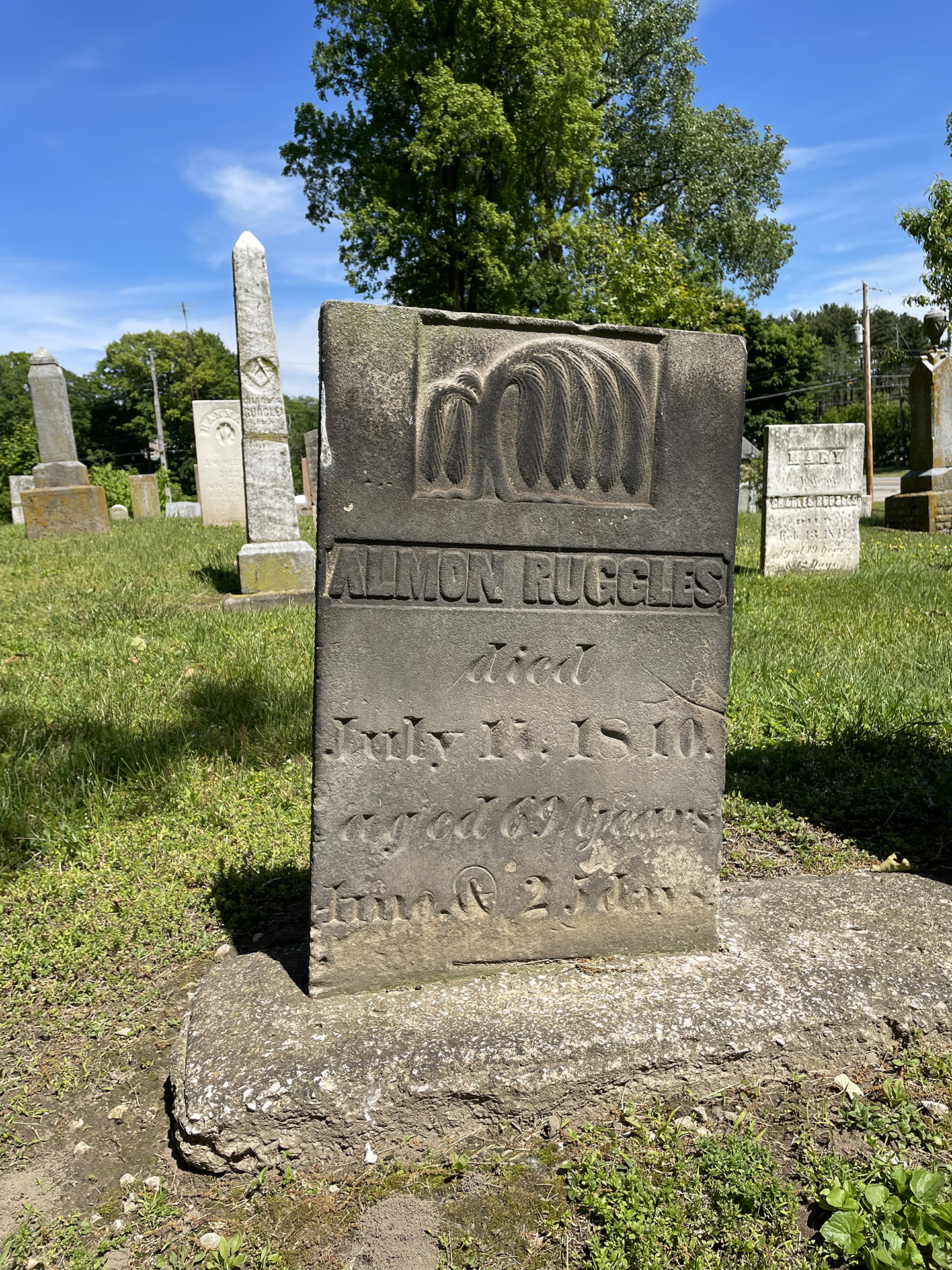
While out at Ruggles Beach, I decided to stop at the Berlin Township Oak Bluff Cemetery and pay a visit to Almon Ruggles' grave. But first I grabbed a shot of the Ohio Historical Marker (
above) honoring him for his contributions as a surveyor of the Firelands, a member of the Ohio House, the Ohio Senate and also a judge of Huron County.
It was easy to find his gravestones, and I'm happy to report that they have received some much needed care since my last visit in 2011. They're in great shape.
A pair of
Lorain Journal articles below, part of a series written by Wallace White, provide a detailed history of two surveys that included the Firelands in which Almon Ruggles participated. The first article tells how an uncalibrated chain likely led to an error during the 1806 Pease survey; the second article tells how they had to resurvey the area (in less-than-pleasant conditions) in 1808 with impressively accurate results.
 |
| March 24, 1960 |
 |
| April 7, 1960 |


We have a Ruggles township south of me a little on 60 in Asland county. Have a friend there they call him The Man from Ruggles
ReplyDeleteMy brother was a surveyor's chain- and pole-man back in the day before GPS. He tells stories a lot like the ones in the articles, though he and his boss drove back and forth to sites in a VW Bug and didn't have to shoot squirrels to eat.
ReplyDeleteSigns of crummy surveys are all around us. Like, in Lorain County, the westernmost townships are all truncated because an eastward-heading survey met a western-heading one (likely Mr. Ruggles as described above) and a mile's worth of difference between the two had to be accounted for.
I have always been impressed that surveyors could measure 66 feet at a time, through swamps and woods with no long sight lines, over hill and mountain and account for the slope error vs flat land and get everything as accurately as they did.
ReplyDeleteEarly steel tapes were made by Justice Roe and Sons on Long Island, some of my ancestors. I have a Roe demolition tape from WW II. You measure various things using a chart such as bridges, walls and embankments and the tape calculates the amount of TNT needed to breach it. When I called the Roe company back in the 1990s and asked about the tape the gentleman I talked said, "What you have there, son, is a classified military item". However, they had been declassified after the Vietnam War.
Dennis: Your Demolition Tape sound very interesting. Never heard of such a thing, though the need is obvious if you think about it. I see several for sale online, but how-to-use info is scarce. I found one set of instructions, but I think they're in Zee Dutch. https://www.rekeninstrumenten.nl/MIR/PDF/MIR48_23_26.pdf
DeleteEarly in my career, I created geologic maps with a plane table and telescopic alidade and used line-of-site triangulation, declination, and inclination instead of chains. I was always astonished at the quality of my measures (when I was careful, accurate, and precise). It wasn't intended to replace surveyors, but two people could cover a huge amount of ground in a very short time and shoot *over* swamps and other similar obstacles instead of wading through them. But you had to get up high to take advantage of the method.
I always felt sorry for my brother and all the crap he had to put up with, though he claimed dealing with landowners was far more difficult than any landform.
Another great post. Thanks for covering Ruggles’ important local history
ReplyDelete