 |
| Courtesy Lorain Historical Society |
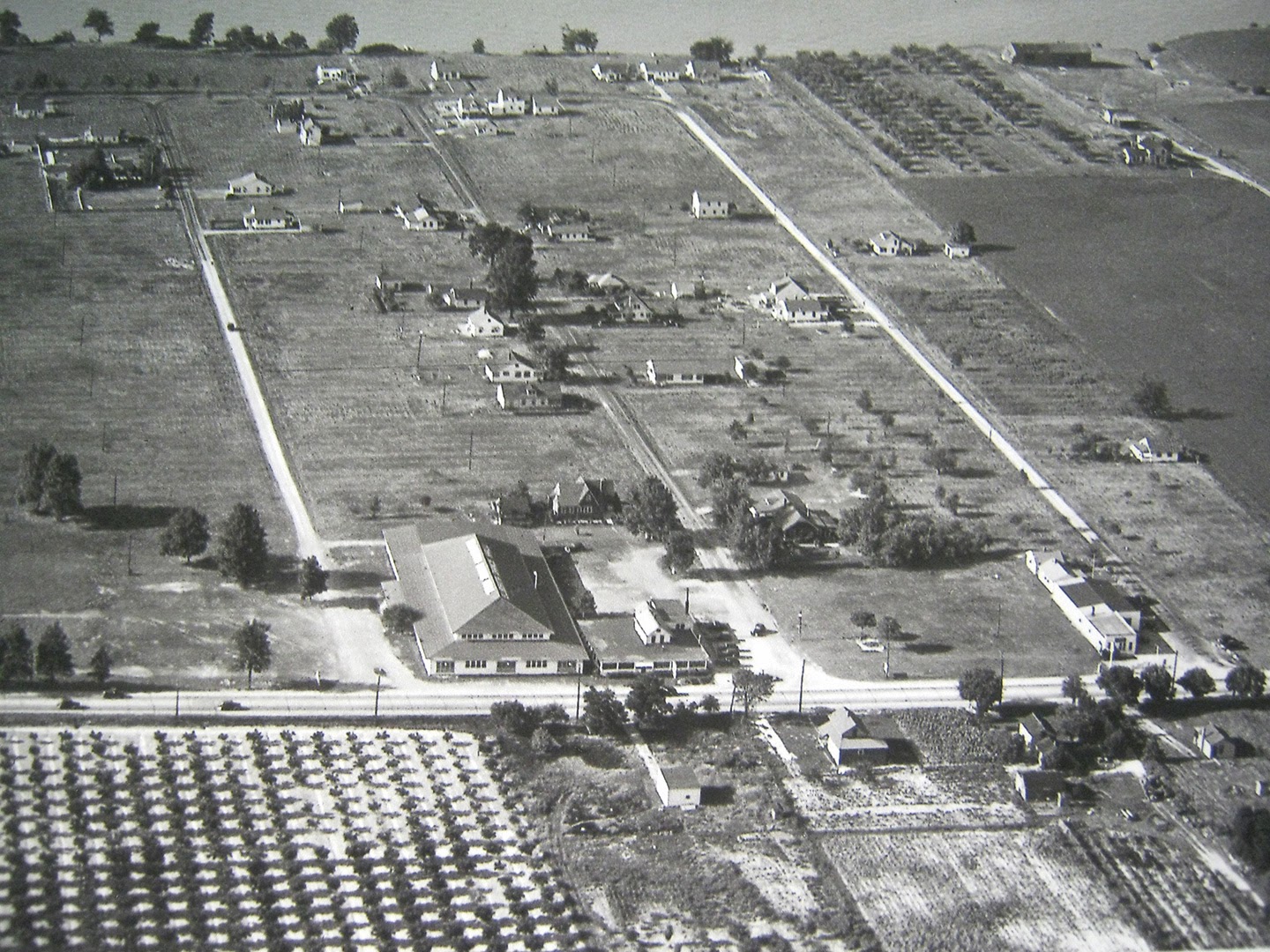
Now anyone who reads this blog for any length of time knows I like a good mystery to solve (I just love wasting time) – so I was determined to find out where this photo was taken.
Although I had studied the photo carefully – paying particular attention to the large building fronting the highway – I just couldn't place it. My guess was that the photo was taken way west of Lorain, perhaps out near Sandusky or Huron. (The lake is at the top of the photo, so that had to be Route 6 and/or Lake Road near the bottom – assuming the photo was taken in Northeast Ohio!)
Anyway, I was preparing this post with the intent of asking for help from my readers, when I suddenly realized that the smaller building to the right of the large building looked familiar to me.

And here it is – a 1950s era photo of the Elberta Inn (below) – which coincidentally burned down three years ago today.
 |
| Courtesy Rick Tarrant |
(Click on this link, and scroll down for Rich's post about the history of Elberta Inn and how it was moved back from the highway in the 1950s.)
I'm not exactly sure when the Elberta Beach Dance Hall closed. According to an online newspaper article, its roof was heavily damaged by the wind – blown off, in fact – in January 1949.
I contacted Rich Tarrant about the dance hall. He explained, "It was partially destroyed during a tornado. Part of it still exists. It's the building just to the west of where Elberta stood until it burned."
Rich also revealed why the name "Elberta" was given to the inn, dance hall and road. The nearby orchards in the vintage photo are "Elberta Peach orchards."
Finally, here's the "now" shot of the area shown in the vintage aerial photo.

You can see the "footprint" left by the now-demolished Elberta Inn where Elberta Road meets Route 6.


As soon as I saw the pic, I thought it was the Elberta Inn. Then I thought NO its to close to the road. You learn something everyday.That must have been some tough move!
ReplyDeleteVery cool. I trust some of the other aerial photos you found will appear in future posts?
ReplyDeleteThere's one other "mystery photo", but I solved that one too yesterday! It's outside of Lorain County--but it'll show up here eventually!
ReplyDeleteBack in the mid 80s we were in the Crazy Craft race in the Vermilion Fish Festival. We always raced against a craft from the Elberta Inn. They always were having a good time! :)
ReplyDelete