 |
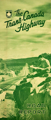
| 1960s brochure |
Canada has been a regular topic on this blog since I launched it back in 2009.
Why? Because I have a strong affection for the Great White North. I spent a lot of time in Canada over a twenty year period beginning in the late 1980s, with regular trips to Toronto, Niagara Falls and North Bay – sometimes several times a year.
I still make it up to Windsor every few years, but I miss driving Canada's great highways, such as the QEW (Queen Elizabeth Way) and Highway 11. The roads were always in great shape and the scenery was always interesting, especially once you got a few hours north of Toronto. I really miss it, and plan to hit the road again, eh, once I finally retire.
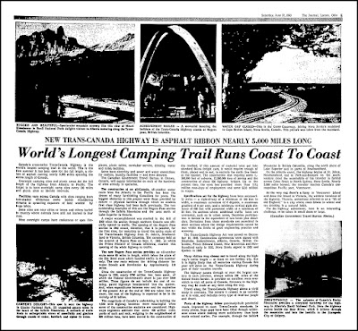
Anyway, one of the landmark highways is the Trans-Canada highway. And as the article below from the June 22, 1963 Lorain Journal explains, the summer of 1963 was the first time that the highway was open for the entire length, "a ribbon of asphalt running nearly 5,000 miles spanning the entire length of Canada."
There was a strong marketing push to promote the Trans-Canada Highway. Consequently there were many maps and brochures distributed to literally 'increase traffic' as an ad man might say. Looking at these vintage printed publications makes me feel wistful and nostalgic for the days when we navigated using maps.
I did drive a portion of the Trans-Canada Highway back in 1997, the section from North Bay to Sault St. Marie. It was very scenic, but much of the area around Sudbury looked like a lunar landscape thanks to its mining heritage.


No comments:
Post a Comment