Looking for something interesting to do? Take an autumn walk in the Bacon Woods in the Vermilion River Reservation, and enjoy a little piece of hidden history: the abutments of an old abandoned bridge.
Longtime contributor and local historian Dennis Thompson first told me about the abutments. As Dennis pointed out, many years ago the road we know today as Cooper Foster Park Road used to cross the Vermilion River, instead of dead-ending at Vermilion Road and trailing off into the trees as a driveway as it does today.
 |
| The view looking west across Vermilion Road from Cooper Foster Park Road |
Dennis noted that the road “crossed Vermilion Road, wound around an S curve and dropped down the valley and across the river.
"The Coopers owned from Vermilion Road to the river,” said Dennis.
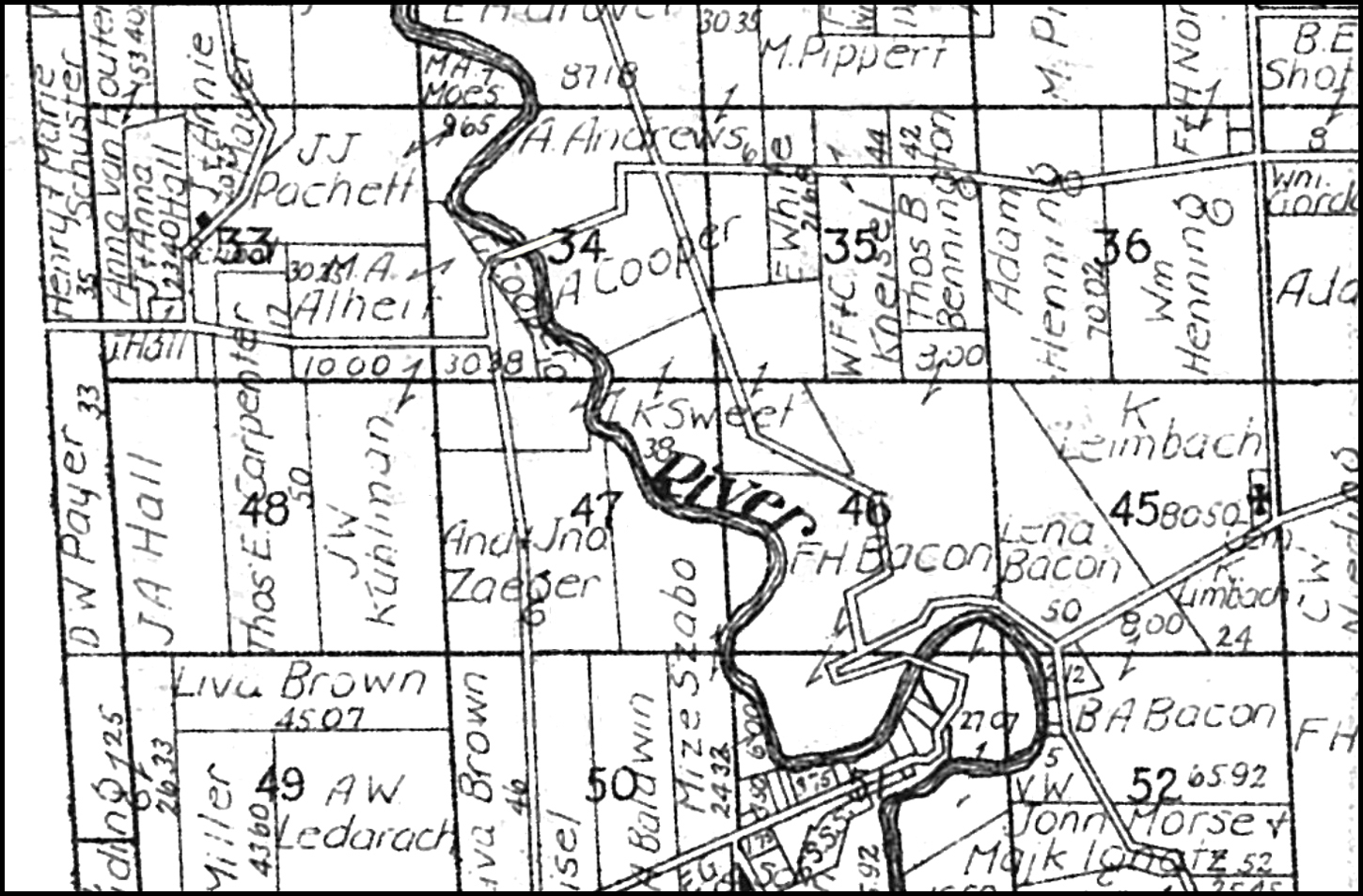
You can see the old road crossing the Cooper property on these vintage township maps, right where the “34” (for Township Lot 34) is.
 |
| 1912 |
 |
| 1916 (Courtesy of Dennis Lamont) |
 |
| 1930 |


Have heard rumors about that bridge - and actually started out to try and find it waaaaay back in the day via th emill hollow trails, but ended up turning around.
ReplyDeleteWhat changed the course of the mighty river; certainly not Superman.
ReplyDeleteI would like to know too,what happened to the river?And the bridge?Were the Coopers 1%ers,who paid for its removal?Or did they pressure the state to have it torn down?
ReplyDeleteI remember riding across the bridge with my dad when I was a kid in the 1950s. With the steep approaches to the bridge it seemed especially wild. If I remember correctly it was a single lane bridge and seemed pretty rickety even then. After the bridge was closed fishermen would park along Darrow Road and walk the old road down to the river to fish -- maybe they still do. Probably about 30 years ago the metro parks employed a ranger named Roy Hartman who often led rather adventurous hikes through the various parks. Back then I joined him once for a hike to the old bridge site. Then there was no path then, it was a bushwhack. I was told that on the the small rise on the east side of the cliff just before you descend into the valley many Native American artifacts were found. A house now stands on the site.
ReplyDeleteBefore anyone comments more ridiculous theories on why the bridge is no longer there in the 1969 photo, please read about the July 4th flood of 1969 http://ohsweb.ohiohistory.org/swio/pages/content/1969_flood.htm#:~:text=July%204%2C%201969%3A%20Independence%20Day%20Flood&text=Flooding%2C%20winds%20up%20to%20100,104%20small%20businesses%20were%20destroyed.&text=Record%20floods%20were%20reached%20on,River%2C%20and%20the%20Black%20River.
ReplyDelete